Home
Weather New York
WeatherRadar
RainRadar
TemperatureRadar
WindRadar
LightningRadar
Weather News
Editor's Pick
Discover the app
Weather widget
Contact us
Apps
Career
    Home / Weather News /

    Phoenix to Flagstaff - Elevation makes all the difference

06:13 PM
June 4, 2026

Phoenix to Flagstaff
Elevation makes all the difference

Although a relatively 'short' distance away, Flagstaff and Phoenix deal with very different climates.

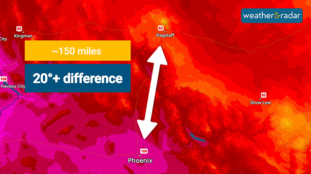
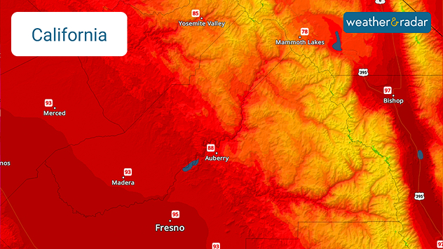
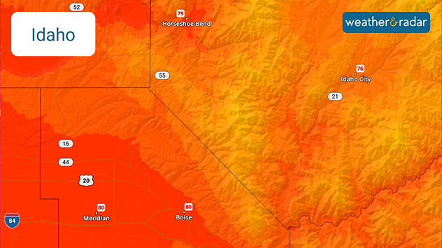
On the TemperatureRadar, it looks like Phoenix and Flagstaff are experiencing completely different weather systems simply because their high temperature forecasts are 24 degrees apart. However, it comes down to their differences in elevation.

Arizona's topography transitions quickly from flat desert to high mountain peaks. In fact, Phoenix and Flagstaff are only around 150 miles apart, but Flagstaff is almost 6,000 feet higher than the Phoenix valley. You can see the topographical differences when zooming in on the WeatherRadar.

The changes in elevation greatly impact the weather. The higher you go in the atmosphere, the cooler the temperatures. This is also why you see snow falling in the mountains and rain in the valleys - yes, even on a spring or summer day for the highest peaks.

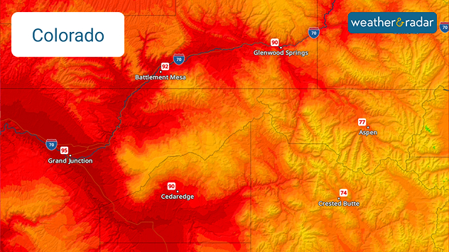
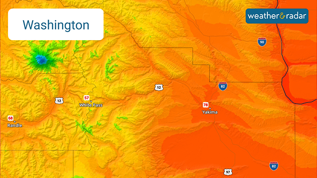
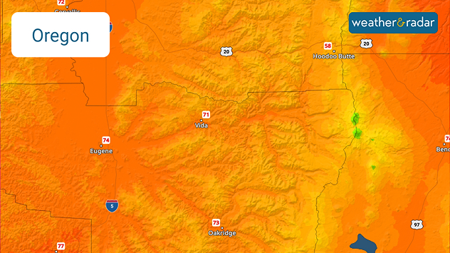
You can find this vast difference in temperatures in other mountain spots across the U.S., like in Colorado, Washington, Oregon, California and Idaho.

Colorado's topography creates different climates depending on elevation.
Washington's topography creates different climates depending on elevation.
Oregon's topography creates different climates depending on elevation.
California's topography creates different climates depending on elevation.
Idaho's topography creates different climates depending on elevation.
1/5
Becca Parker
More on the topic
Super Typhoon Near the Philippines. Gusts up to 155. . . Tuesday, June 23, 2026
Tuesday, June 23, 2026

Gusts up to 155

Super Typhoon Near the Philippines
Super Typhoon Bavi threatens Taiwan. 155 mph winds. . Weather Videos. Wednesday, July 8, 2026
The image shows an intense tropical cyclone over the western Pacific, east of Taiwan and the Philippines. The centre of the system is depicted as a light purple and white vortex with a clearly visible eye, surrounded by a ring of red and orange areas indicating the strongest wind speeds. A white arrow marks the typhoon’s predicted track towards the north-west, in the direction of Taiwan. To the west of the storm lie the Philippines, with the cities of Manila and Cebu; to the north of these lies Taiwan, with Taipei. Further west, the Chinese coast, including Hong Kong, and parts of Vietnam can be seen. The coloured wind map shows predominantly green areas outside the storm’s core, indicating significantly weaker winds. White streamlines illustrate the typhoon’s anti-clockwise circulation in the Northern Hemisphere. The highest wind speeds are concentrated around the eye of the cyclone.
Weather VideosWednesday, July 8, 2026

155 mph winds

Super Typhoon Bavi threatens Taiwan
High pressure & extreme heat. Why & how does it work?. . . Sunday, July 12, 2026
Sunday, July 12, 2026

Why & how does it work?

High pressure & extreme heat
All weather news
This might also interest you
Turning hot this weekend. Brutal temps across West. . . Friday, July 10, 2026
Saturday & Sunday's highs
Friday, July 10, 2026

Brutal temps across West

Turning hot this weekend
100 miles, 30-degree difference. Southern California. . . Thursday, July 9, 2026
Thursday, July 9, 2026

Southern California

100 miles, 30-degree difference
6 easy steps to take now to be ready. Hurricane preparedness. . . Sunday, July 12, 2026
Are you ready?
Sunday, July 12, 2026

Hurricane preparedness

6 easy steps to take now to be ready
All articles
Weather & Radar

Weather & Radar is also available on

Google Play StoreApp Store

Company

Contact us Privacy policy Legal info Accessibility statement

Services

Uploader

Socials

instagramfacebookthreadslinkList