Home
Weather New York
WeatherRadar
RainRadar
TemperatureRadar
WindRadar
LightningRadar
Weather News
Editor's Pick
Discover the app
Weather widget
Contact us
Apps
Career
    Home / Weather News /

    Possible storm - Heavy rains for southern Texas

08:00 PM
August 14, 2025

Possible storm
Heavy rains for southern Texas

This Thursday afternoon, a low-pressure system shows more signs of tropical life during the next 48 hours.

The disturbance, located over the southern Gulf, is attempting to organize during the remainder of Thursday and Friday. The National Hurricane Center gives it a 40 percent chance of development during the next two days. Its general motion is westward-northwestward, which will gradually increase rainfall for the Mexican east coast and possibly over southern Texas.

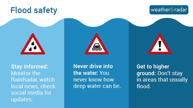
Flood safety tips: Stay informed, never drive into the water and get to higher ground

There's a very short window for this system to organize, but residents of the Mexican states of Veracruz and Tamaulipas and extreme southern Texas should remain vigilant. Torrential rains and possible flooding are expected even if the system doesn't manage to define its center and be named. Hurricane hunters are en route to investigate this system. We will bring you another update as we learn more details about the data collected by the scientists on board the aircraft.

Irene Sans
More on the topic
How does fog form?. Multiple ways. . . Saturday, July 11, 2026
Saturday, July 11, 2026

Multiple ways

How does fog form?
Super Typhoon Bavi threatens Taiwan. 155 mph winds. . Weather Videos. Wednesday, July 8, 2026
The image shows an intense tropical cyclone over the western Pacific, east of Taiwan and the Philippines. The centre of the system is depicted as a light purple and white vortex with a clearly visible eye, surrounded by a ring of red and orange areas indicating the strongest wind speeds. A white arrow marks the typhoon’s predicted track towards the north-west, in the direction of Taiwan. To the west of the storm lie the Philippines, with the cities of Manila and Cebu; to the north of these lies Taiwan, with Taipei. Further west, the Chinese coast, including Hong Kong, and parts of Vietnam can be seen. The coloured wind map shows predominantly green areas outside the storm’s core, indicating significantly weaker winds. White streamlines illustrate the typhoon’s anti-clockwise circulation in the Northern Hemisphere. The highest wind speeds are concentrated around the eye of the cyclone.
Weather VideosWednesday, July 8, 2026

155 mph winds

Super Typhoon Bavi threatens Taiwan
High pressure & extreme heat. Why & how does it work?. . . Sunday, July 12, 2026
Sunday, July 12, 2026

Why & how does it work?

High pressure & extreme heat
All weather news
This might also interest you
Rainfall deficit tops a foot. Southeast Florida. . . Tuesday, August 18, 2026
All heat and no rain for Southeast Florida today.
Tuesday, August 18, 2026

Southeast Florida

Rainfall deficit tops a foot
What to know this hurricane season. Knowledge is power. . . Sunday, August 23, 2026
Hurricanes approaching the coastline can cause extensive impacts, including flooding, even before landfall.
Sunday, August 23, 2026

Knowledge is power

What to know this hurricane season
Days of record nighttime heat. Feeling tropical. . . Monday, August 17, 2026
Monday, August 17, 2026

Feeling tropical

Days of record nighttime heat
All articles
Weather & Radar

Weather & Radar is also available on

Google Play StoreApp Store

Company

Contact us Privacy policy Legal info Accessibility statement

Services

Uploader

Socials

instagramfacebookthreadslinkList