Home
Weather New York
WeatherRadar
RainRadar
TemperatureRadar
WindRadar
LightningRadar
Weather News
Editor's Pick
Discover the app
Weather widget
Contact us
Apps
Career
    Home / Weather News /

    Wet & snowy end to the week

03:27 PM
April 5, 2024

West Coast weathermaker
Wet & snowy end to the week

A large storm system is making its way inland into the U.S.

The last bits of rainfall will wrap up across the West, especially California, this Friday, but heavy Sierra Nevada and northern Great Basin snowfall will linger. Gusty winds are causing travel issues on top of that. The next storm approaches for the Pacific Northwest on Saturday.

Low pressure churning off the California Coast is bringing lower elevation rainfall and mountain snow from central California to southern Washington and eastward to the northern Rockies, as seen on the WeatherRadar.

The wet and wintry weather will continue through today and the first half of Saturday before another storm makes its way into the Pacific Northwest Coast, bringing more rain and snow.

You can look forward to high pressure by Monday to catch a glimpse of the partial solar eclipse visible in the West.

Solar eclipse hubread more

Winter weather advisories and winter storm warnings are posted for the Sierras, the northwest California mountains, SoCal mountains, and northern Nevada. Up to 12 inches could pile up by late Friday as the storm continues inland.

As for the rainfall, up to a quarter and half an inch are expected and flash flooding issues are not widespread. Only keep an eye on the areas that often see issues with any rainfall.

Winds!

The windy side of this current storm is focusing on the Four Corners. Wind advisories and high wind warnings have been posted. Sustained winds could reach 40 mph with gusts greater than 60 mph. High-profile vehicles should keep a close eye on the WindRadar and be prepared to postpone a trip until the winds die down.

The next frontal system is not expected until early Saturday afternoon, affecting the Pacific Northwest Coast. More rain and mountain snow are expected, so keep a close eye on the WeatherRadar to modify weekend plans.

Becca Parker

More on the topic

Record ocean heat halting hurricanes. Strong El Niño influence. . . Sunday, September 13, 2026
A weather map shows a calm Atlantic Ocean with no hurricanes, alongside a picture of the sea.
Sunday, September 13, 2026

Strong El Niño influence

Record ocean heat halting hurricanes
Why do leaves change color in autumn?. The transformation begins. . . Saturday, October 17, 2026
Autumn leaves
Saturday, October 17, 2026

The transformation begins

Why do leaves change color in autumn?
10 facts about fog. Low clouds. . . Sunday, September 27, 2026
Fog impacting the Appalachian Mountains.
Sunday, September 27, 2026

Low clouds

10 facts about fog
All weather news

This might also interest you

Autumn foliage: weather's impact. Leaf-peeping season!. . . Saturday, October 31, 2026
Cool nights can help intensify autumn foliage color!
Saturday, October 31, 2026

Leaf-peeping season!

Autumn foliage: weather's impact
Busy week for West. WeatherFeed. . . Monday, November 16, 2026
Monday, November 16, 2026

WeatherFeed

Busy week for West
The different winter precipitation types. Snow, sleet, graupel.... . . Saturday, November 14, 2026
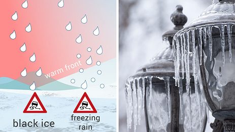
Split image of freezing rain turned to ice over street lamps and infographic describing the different precipitation types.
Saturday, November 14, 2026

Snow, sleet, graupel...

The different winter precipitation types
All articles
Weather & Radar

Weather & Radar is also available on

Google Play StoreApp Store

Company

Contact us Privacy policy Legal info Accessibility statement

Services

Uploader

Socials

instagramfacebookthreadslinkList