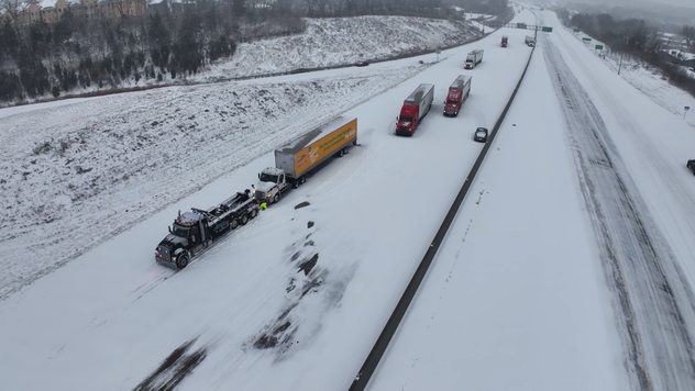
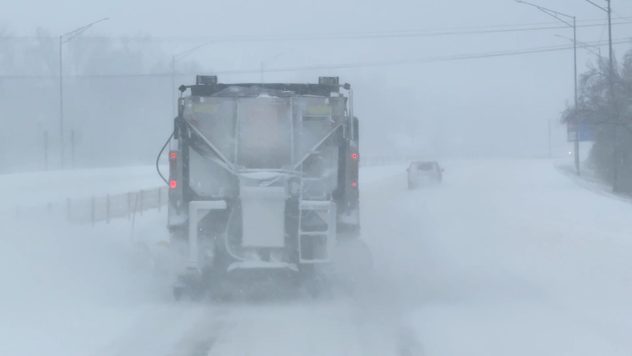
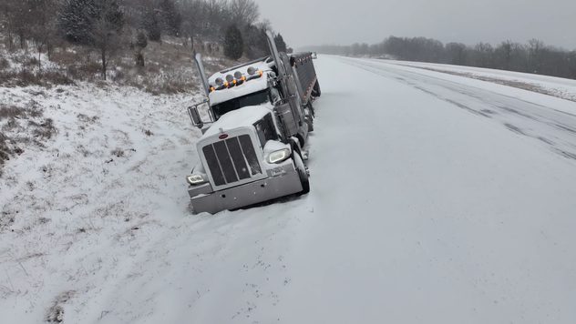
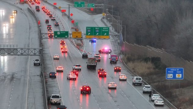
Home
Weather New York
WeatherRadar
RainRadar
TemperatureRadar
WindRadar
LightningRadar
Weather News
Editor's Pick
Discover the app
Weather widget
Contact us
Apps
Career
Home / Weather News /

Winter storm blankets the U.S., timelapse video shows quickly accumulating snow in Kentucky

Timelapse
Winter storm blankets U.S.

A timelapse of snow blanketing Louisville, Ky., captures a scene millions of Americans experienced Sunday as the season's first winter storm brought heavy snow and disruptions across the U.S.

The timelapse above captures heavy snow blanketing Louisville, Ky., on Sunday, January 5, swiftly transforming driveways and lawns in just a few hours.

Location72-hour snow totals
Alexandria, Va.6"
Cincinnati, Ohio9"
Indianapolis, Ind.9.4"
Louisville, Ky.10.5"
Kansas City Intl Airport11"
The table shows snow accumulations in the past 72 hours since Noon, Monday, Jan. 6, 2025.

Snowfall rates of two inches per hour were reported in and around the town, reducing visibility and hazardous driving conditions throughout the day.

The winter storm swept the central, southern, and northeastern United States, bringing snowfall, freezing temperatures, and severe weather. Over a foot of snow accumulated in parts of the Ohio Valley and Central Plains, while Washington, D.C., and other areas of the Mid-Atlantic were expecting up to 10 inches.

1/5
Abandoned semi-trucks along Kansas City highway on Jan. 5, 2025.

In Kansas City, the storm brought 11 inches of snow, marking the city’s most significant snowstorm in over three decades. The last time Kansas City experienced this much snowfall was in February 1993. With bitterly cold air moving in behind the storm, the snow is expected to linger for some time. Check the TemperatureRadar to see just how cold it will get.

Frigid Arctic air compounded the storm’s impact, causing icy conditions and power outages affecting over 250,000 homes. Widespread travel disruptions, including over 3,000 flight cancellations, left many stranded. Authorities in multiple states declared emergencies, urging residents to stay indoors as the storm continued its trek eastward.

The Weather & Radar team covered this event LIVE on the Live Blog on Sunday. Tap here for more impact videos and reports from Weather & Radar storm reporter Jonathan Petramala.

Federico Di Catarina
This might also interest you
Nashville Ice
Tuesday, January 27, 2026

Day 3 without power

South recovers from ice slowly
Monday, January 26, 2026

Daily briefing

Frigid air mass settles in, storm wraps up
Saturday, January 31, 2026

Gusts topping 75 mph

Winter storm to intensify Saturday
All articles
Weather & Radar
US
Clima & Radar Brasil
Hava durumu & Radar Türkiye
Időjárás és Radar Magyarország
Καιρός & Ραντάρ Ελλάδα
Météo & Radar Belgique (Français)
Météo & Radar France
Meteo & Radar Italia
Meteo & Radar România
Météo & Radar Suisse (Français)
Meteo & Radars Latvija
OrasOnline Lietuva
Počasí & Radar Czechia
Počasie & Radar Slovensko
Pogoda & Radar Polska
Погода & Радар Україна (українська)
Tempo & Radar Portugal
Tiempo & Radar Argentina
Tiempo & Radar España
Vejr & Radar Danmark
Vreme & Radar Slovenija
Vreme & Radar Srbija
Vrijeme & Radar Bosna
Vrijeme & Radar Crna Gora
Vrijeme & Radar Hrvatska
Време & Радар България
Времето & Радар Macedonia
Weather & Radar India (English)
Weather & Radar Ireland
Weather & Radar United Kingdom
Weather & Radar USA (Español)
Weer & Radar België (Nederlands)
Weer & Radar Nederland

Weather & Radar is also available on

Google Play StoreApp Store

Company

Contact us Privacy policy Legal info Accessibility statement

Services

Uploader

Socials

instagramfacebookthreadslinkList