Home
Weather New York
WeatherRadar
RainRadar
TemperatureRadar
WindRadar
LightningRadar
Weather News
Editor's Pick
Discover the app
Weather widget
Contact us
Apps
Career
    Home / Editor's Pick /

    WMO report - Heat is affecting agriculture

07:00 PM
April 26, 2026

WMO report
Heat is affecting agriculture globally

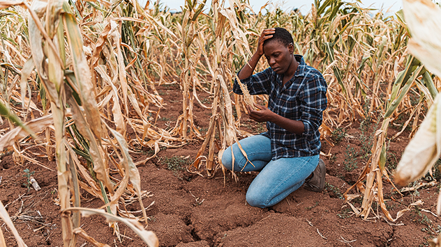
A young woman is kneeling in a cornfield, tending to her plants

Livestock and crops are increasingly suffering from more frequent episodes of extreme heat.

According to a report by the World Meteorological Organisation (WMO) and the Food and Agriculture Organisation of the United Nations (FAO), this is threatening the livelihoods of over a billion people.

Heatwaves have become noticeably more frequent in recent decades. They occur more often, last longer and are more intense. And this trend is set to continue. This is becoming an increasing problem, particularly for the agricultural sector.

Plants produce a lower yield

Many animals start to suffer from heat stress at temperatures as low as 25 degrees, whilst pigs and chickens are affected even earlier. Crops such as potatoes and barley produce lower yields in extreme heat. What’s more, fires occur more frequently and can destroy entire fields.

For farmers themselves, working conditions are becoming more difficult. In some regions, particularly in South Asia, Africa, and Central and South America, it could simply be too hot for field work on up to 250 days a year in the future.

At the same time, droughts, water shortages, pests and diseases are on the rise – without effective climate action, the situation will continue to worsen.

Current temperatures worldwideTemperatureRadar
Michael Krucker
with material from dpa
More on the topic
Super Typhoon Bavi threatens Taiwan. 155 mph winds. . Weather Videos. Wednesday, July 8, 2026
The image shows an intense tropical cyclone over the western Pacific, east of Taiwan and the Philippines. The centre of the system is depicted as a light purple and white vortex with a clearly visible eye, surrounded by a ring of red and orange areas indicating the strongest wind speeds. A white arrow marks the typhoon’s predicted track towards the north-west, in the direction of Taiwan. To the west of the storm lie the Philippines, with the cities of Manila and Cebu; to the north of these lies Taiwan, with Taipei. Further west, the Chinese coast, including Hong Kong, and parts of Vietnam can be seen. The coloured wind map shows predominantly green areas outside the storm’s core, indicating significantly weaker winds. White streamlines illustrate the typhoon’s anti-clockwise circulation in the Northern Hemisphere. The highest wind speeds are concentrated around the eye of the cyclone.
Weather VideosWednesday, July 8, 2026

155 mph winds

Super Typhoon Bavi threatens Taiwan
Longest day of the year is here. Summer solstice. . . Sunday, June 21, 2026
Sunday, June 21, 2026

Summer solstice

Longest day of the year is here
High pressure & extreme heat. Why & how does it work?. . . Sunday, July 12, 2026
Sunday, July 12, 2026

Why & how does it work?

High pressure & extreme heat
All weather news
This might also interest you
How does a hurricane form?. Hurricane preparedness. . . Sunday, July 19, 2026
hurricane maria
Sunday, July 19, 2026

Hurricane preparedness

How does a hurricane form?
Dry vegetation, low humidity and winds. The perfect fire recipe. . . Sunday, July 26, 2026
Sunday, July 26, 2026

The perfect fire recipe

Dry vegetation, low humidity and winds
Lopsided Bertha moves west. Who sees the impacts. . . Thursday, July 23, 2026
Thursday, July 23, 2026

Who sees the impacts

Lopsided Bertha moves west
All articles
Weather & Radar

Weather & Radar is also available on

Google Play StoreApp Store

Company

Contact us Privacy policy Legal info Accessibility statement

Services

Uploader

Socials

instagramfacebookthreadslinkList