Home
Weather New York
WeatherRadar
RainRadar
TemperatureRadar
WindRadar
LightningRadar
Weather News
Editor's Pick
Discover the app
Weather widget
Contact us
Apps
Career
    Home / Weather News /

    Blizzard 2022: Over two feet of snow, 81mph gusts; arctic air settles

01:55 AM
January 30, 2022

Officially: Blizzard 2022
2ft of snow, 81mph gust; frigid temps

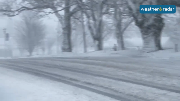
 Parts of Cape Cod experienced blizzard conditions on Saturday January 29.
© Darius Aniunas

We have an official word from the National Weather Service! We had 6 official sites that registered blizzard conditions across eastern Massachusetts and 4 across Rhode Island.

What is a bomb cyclone?

The official definition of a blizzard coming from the National Weather Service in Boston explains that snow falling or blowing reduces visibility to less than ¼ mile and frequent gusts must measure at least 35 mph. All this must happen for at least 3 consecutive hours.

The snow started falling late Friday night across the New England area, intensifying on Sunday. Residents tried to shovel some of the snowdrifts out from their driveway and walkways before new bands arrived.

Gusts and snow totals recorded

The highest gusts were recorded in Yarmouth, Massachusetts in the Cape Cod area shortly after noon on Saturday, while other areas across eastern Massachusetts and Rhode Island measured gusts between 45 and 76 mph.

Until 6 p.m. on Saturday, the highest snowfall total was recorded in Pembroke, Ma., with 26 inches. Bridgewater, Massachusetts of 24 inches. Norton, Ma., reached 24.5 inches, and Easton, Ma., got 22 inches.

The rest of the weekend

More snow is expected to fall through the early evening hours and taper off slowly. Total snowfall amounts could still increase across some locations.

Northwest weather change: Foggy weather breaks down

By Sunday, the sunshine will be back, but the frigid temperatures will stay put. By sunrise, Boston’s temperatures will be around 5 degrees, but the winds will make them feel as if they were 12 degrees below zero. The afternoon will reach a high temperature of 21 degrees, and although the wind will gradually diminish the snow on the ground will keep the temperatures feeling as if they were around 11 degrees F.

Irene Sans
More on the topic
Waterspouts possible, what are they?. They can be dangerous. . . Saturday, July 11, 2026
Waterspouts weatherradar.
Saturday, July 11, 2026

They can be dangerous

Waterspouts possible, what are they?
High pressure & extreme heat. Why & how does it work?. . . Sunday, July 12, 2026
Sunday, July 12, 2026

Why & how does it work?

High pressure & extreme heat
How does fog form?. Multiple ways. . . Saturday, July 11, 2026
Saturday, July 11, 2026

Multiple ways

How does fog form?
All weather news
This might also interest you
Flooding rains shift north along I-95. 5 inches more. . . Wednesday, July 29, 2026
Extreme weather alerts are active as heavy rain could cause flooding issues.
Wednesday, July 29, 2026

5 inches more

Flooding rains shift north along I-95
Southwest heat disrupts daily flow. Closures & delays. . . Monday, July 27, 2026
Monday, July 27, 2026

Closures & delays

Southwest heat disrupts daily flow
Low pressure brings wet weekend. Soggy East. . . Friday, July 31, 2026
Friday, July 31, 2026

Soggy East

Low pressure brings wet weekend
All articles
Weather & Radar

Weather & Radar is also available on

Google Play StoreApp Store

Company

Contact us Privacy policy Legal info Accessibility statement

Services

Uploader

Socials

instagramfacebookthreadslinkList