Home
Weather New York
WeatherRadar
RainRadar
TemperatureRadar
WindRadar
LightningRadar
Weather News
Editor's Pick
Discover the app
Weather widget
Contact us
Apps
Career
    Home / Weather News /

    Matching hats & gloves - Coolest KY Derby in at least 15 years

11:00 AM
May 2, 2026

Matching hats & gloves
Coolest KY Derby in at least 15 years

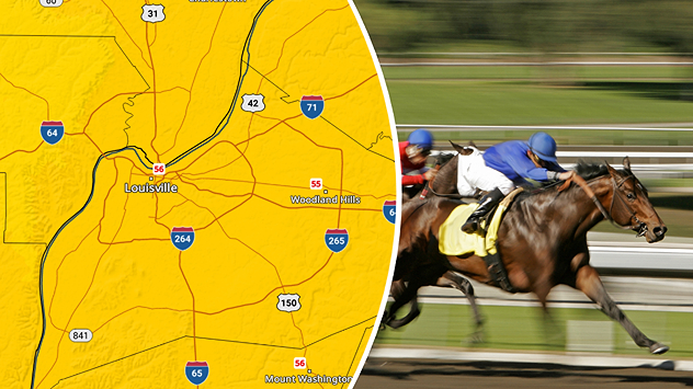
The 2026 Kentucky Derby is likely to be the coolest in at least 15 years with highs in the mid-50s.
TemperatureRadar: The 2026 Kentucky Derby is likely to be the coolest in at least 15 years, with highs in the mid-50s.

The average temperature during the Kentucky Derby is around the mid-70s, but this year, the TemperatureRadar shows highs in the mid-50s. The most comfortable attendants may be the horses.

Cooler temperatures are trending in the eastern half for the start of May, and those at Churchill Downs will be feeling the spring chill. Highs in the mid-50s will have many matching gloves and scarves to their event-ready hats.

Louisville's forecast shows cool temperatures sticking around all weekend before more seasonable warmth briefly returns on Monday. Thankfully, the sun will be shining for the race.

Louisville

Fr
69
86
Sa
73
82
Su
73
79
Mo
70
74
Tu
71
78
We
71
85
Th
70
86
Fr
73
89
Sa
75
91
Su
74
90
Mo
74
89
Tu
72
88
We
75
89
Th
70
85
Max (°F)
Min (°F)
moreless

Temperatures have ranged from the 60s to the 80s over the last 15 years of races, including the 2020 September outlier due to rescheduling during COVID.

Becca Parker
More on the topic
Rip currents & safety tips. As more head to the coast. . . Saturday, July 25, 2026
rip current
Saturday, July 25, 2026

As more head to the coast

Rip currents & safety tips
Record-breaking heatwave in Europe. Hotter than most of U.S.. . . Thursday, June 25, 2026
Thursday, June 25, 2026

Hotter than most of U.S.

Record-breaking heatwave in Europe
Super Typhoon Bavi threatens Taiwan. 155 mph winds. . Weather Videos. Wednesday, July 8, 2026
The image shows an intense tropical cyclone over the western Pacific, east of Taiwan and the Philippines. The centre of the system is depicted as a light purple and white vortex with a clearly visible eye, surrounded by a ring of red and orange areas indicating the strongest wind speeds. A white arrow marks the typhoon’s predicted track towards the north-west, in the direction of Taiwan. To the west of the storm lie the Philippines, with the cities of Manila and Cebu; to the north of these lies Taiwan, with Taipei. Further west, the Chinese coast, including Hong Kong, and parts of Vietnam can be seen. The coloured wind map shows predominantly green areas outside the storm’s core, indicating significantly weaker winds. White streamlines illustrate the typhoon’s anti-clockwise circulation in the Northern Hemisphere. The highest wind speeds are concentrated around the eye of the cyclone.
Weather VideosWednesday, July 8, 2026

155 mph winds

Super Typhoon Bavi threatens Taiwan
All weather news
This might also interest you
Multi-day rain event ends soon. Southeast U.S.. . . Friday, July 24, 2026
Friday, July 24, 2026

Southeast U.S.

Multi-day rain event ends soon
Lopsided Bertha moves west. Who sees the impacts. . . Thursday, July 23, 2026
Thursday, July 23, 2026

Who sees the impacts

Lopsided Bertha moves west
Low pressure brings wet weekend. Soggy East. . . Friday, July 31, 2026
Friday, July 31, 2026

Soggy East

Low pressure brings wet weekend
All articles
Weather & Radar

Weather & Radar is also available on

Google Play StoreApp Store

Company

Contact us Privacy policy Legal info Accessibility statement

Services

Uploader

Socials

instagramfacebookthreadslinkList