Home
Weather New York
WeatherRadar
RainRadar
TemperatureRadar
WindRadar
LightningRadar
Weather News
Editor's Pick
Discover the app
Weather widget
Contact us
Apps
Career
    Home / Weather News /

    Multi-decade heat record broken in Phoenix

07:56 PM
September 3, 2024

Extreme heat
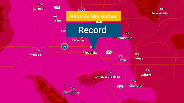
Phoenix's 100 for 100

Phoenix has shattered records with 100 consecutive days of temperatures at or above 100°F!

This streak, which began on May 27 and continues through September 3, 2024, has far surpassed the previous record of 76 days set in 1993. And there is no end in sight yet.

Contributing factors include the Urban Heat Island effect, a lack of cooling thunderstorms, and persistent cloudless skies. The streak nearly ended on August 18, when the high reached 102°F just before midnight. Notably, June 2024 was also the hottest on record for the city.

The longest streak of daily temperatures at or above 100°F is held by Stovepipe Wells, Calif., with an impressive 127 days between May 28 and October 10, 2018.

Phoenix also holds one of the longest streaks for daily average temperatures above 80°F. From May 14 to October 14, 2022, the city experienced 154 consecutive days with daily averages at or above 80°F. The longest streak, however, belongs to Key West, Fla., which recorded 168 days of daily averages at or above 80°F in 2020.

Federico Di Catarina
More on the topic
Super Typhoon Near the Philippines. Gusts up to 155. . . Tuesday, June 23, 2026
Tuesday, June 23, 2026

Gusts up to 155

Super Typhoon Near the Philippines
How does fog form?. Multiple ways. . . Saturday, July 11, 2026
Saturday, July 11, 2026

Multiple ways

How does fog form?
Super Typhoon Bavi threatens Taiwan. 155 mph winds. . Weather Videos. Wednesday, July 8, 2026
The image shows an intense tropical cyclone over the western Pacific, east of Taiwan and the Philippines. The centre of the system is depicted as a light purple and white vortex with a clearly visible eye, surrounded by a ring of red and orange areas indicating the strongest wind speeds. A white arrow marks the typhoon’s predicted track towards the north-west, in the direction of Taiwan. To the west of the storm lie the Philippines, with the cities of Manila and Cebu; to the north of these lies Taiwan, with Taipei. Further west, the Chinese coast, including Hong Kong, and parts of Vietnam can be seen. The coloured wind map shows predominantly green areas outside the storm’s core, indicating significantly weaker winds. White streamlines illustrate the typhoon’s anti-clockwise circulation in the Northern Hemisphere. The highest wind speeds are concentrated around the eye of the cyclone.
Weather VideosWednesday, July 8, 2026

155 mph winds

Super Typhoon Bavi threatens Taiwan
All weather news
This might also interest you
Multi-Day flood threat for Mid-Atlantic. Stalled front. . . Wednesday, July 22, 2026
Wednesday, July 22, 2026

Stalled front

Multi-Day flood threat for Mid-Atlantic
Be prepared for wildfires. By using the app. . . Saturday, July 18, 2026
Wildfires can spark anywhere, anytime. The Weather & Radar app can help you determine your area's risk.
Saturday, July 18, 2026

By using the app

Be prepared for wildfires
Dangerous air quality continues. Canada wildfires smoke. . . Friday, July 17, 2026
Smoky Philadelphia
Friday, July 17, 2026

Canada wildfires smoke

Dangerous air quality continues
All articles
Weather & Radar

Weather & Radar is also available on

Google Play StoreApp Store

Company

Contact us Privacy policy Legal info Accessibility statement

Services

Uploader

Socials

instagramfacebookthreadslinkList