Saturday's live blogDangerous storms erupt across the Plains
Recommended external content from YouTube
We need your consent to show content from YouTube. You can withdraw your consent at any time.
4:00 p.m. CT
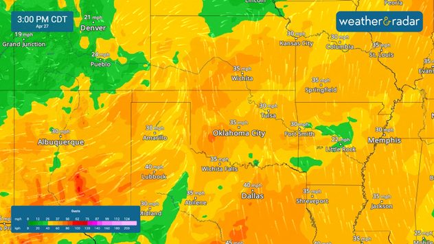
3:00 p.m. CT