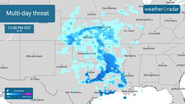
Home
Weather New York
WeatherRadar
RainRadar
TemperatureRadar
WindRadar
LightningRadar
Weather News
Editor's Pick
Discover the app
Weather widget
Contact us
Apps
Career
Home / Weather News /

Texas and the Southeast - Multi-day flood threat

03:06 PM
October 24, 2025

Texas and the Southeast
Multi-day flood threat

Low pressure over the southern and central Plains could bring flash flooding and strong storms today into the weekend.

Moisture is streaming in from the Gulf of Mexico, and as a cold front develops, conditions will become unstable enough to trigger thunderstorms. Some of these storms could turn severe, bringing destructive winds of over 60 mph — especially from western Texas through the I-35 corridor.

Flooding will also be a concern, with the risk zone stretching from Oklahoma down to Fort Stockton, across the Metroplex, and southward along I-35 toward San Antonio. Stay tuned to the WeatherRadar for the latest updates on when storms and rainfall will arrive in your area.

The RainRadar shows a multi-day rain threat for parts of the southern Plains and the Southeast.The RainRadar shows a multi-day rain threat for parts of the southern Plains and the Southeast.

Key Factors to Watch

  1. Path of the System:Rainfall totals and the flood threat will shift eastward from Texas into Alabama between Friday and Sunday.
  2. Rainfall Amounts:Downpours will be intense. Some isolated areas could see 3 to 5 inches of rain, while most regions can expect 2 to 4 inches in a relatively short period — mainly from eastern Texas into Louisiana.
  3. Flooding Vulnerability:Because of the ongoing drought, the dry soil in these areas won’t absorb the water easily, increasing the risk of flash flooding.

The low-pressure system will continue moving east, drawing more Gulf moisture ahead of the storm. This will raise the potential for torrential showers across southeastern Texas, Louisiana, and southern Arkansas on Saturday. By Sunday, a lower—but still notable—risk will extend across western Tennessee, Mississippi, and Alabama.

Mary Mays
More on the topic
Image of a temperature radar showing a clear distinction between a warm and cold air mass separated by a cold front.
Saturday, February 28, 2026

Weather explained

What are weather fronts?
Weather radar with tornado symbol over Michigan next to photo of a destroyed building with collapsed roof and scattered debris.
Extreme WeatherSaturday, March 7, 2026

Deaths, extensive damage

Tornado in Michigan, severe outbreak continues
pothole repair
Thursday, February 26, 2026

Bumpy commute

Cold = spring potholes
All weather news
This might also interest you
Thursday, March 5, 2026

Tornado threat increases

Severe threat continues for Plains
Tuesday, March 3, 2026

New in the app

Your moment, your location, your weather
Monday, March 9, 2026

Through midweek

Record warmth for the Eastern half
All articles
Weather & Radar

Weather & Radar is also available on

Google Play StoreApp Store

Company

Contact us Privacy policy Legal info Accessibility statement

Services

Uploader

Socials

instagramfacebookthreadslinkList