Home
Weather New York
WeatherRadar
RainRadar
TemperatureRadar
WindRadar
LightningRadar
Weather News
Editor's Pick
Discover the app
Weather widget
Contact us
Apps
Career
    Home / Weather News /

    Thursday's live blog - Debby isn't done yet

12:33 PM
August 8, 2024

Thursday's live blog
Debby isn't done yet

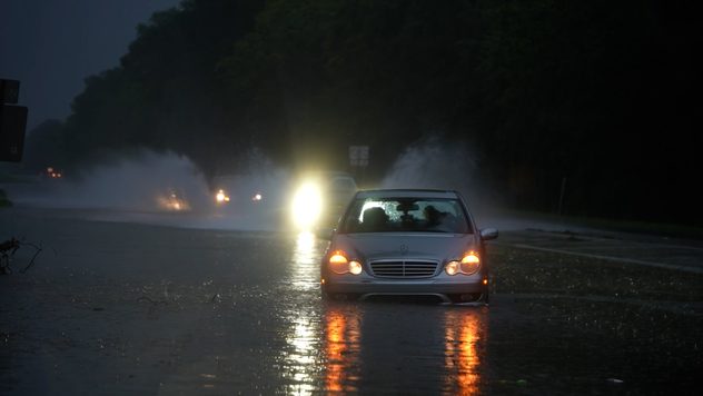
Tropical Storm Debby made a second landfall early this morning after spending some time over the Atlantic. This live blog will track the impacts of this slow-moving storm.

Latest forecast analysisread more

4:30 p.m. ET

Here's a view of Debby's history as it moved across Florida, across Georgia, and into the Carolinas.

4:00 p.m. ET

Weather & Radar meteorologist Irene Sans has the latest forecast on Debby.

3:00 p.m. ET

An early morning tornado damaged a middle school in Lucama, N.C. The torando threat will continue into the evening hours as Debby's outer bands move through.

2:00 p.m. ET

A Tornado Watch is in place until 8:00 p.m. ET for parts of eastern North Carolina and West Virginia.

1:00 p.m. ET

Power outages are growing in North Carolina, where 129,381 homes and businesses are without power. In South Carolina, 12,984 are without power.

12:00 p.m. ET

Debby has brought widespread rain totals of 10-15 inches across parts of southeast Georgia and South Carolina. Some isolated areas have seen 17 inches or more of rain.

11:00 a.m. ET

Here are the details of Debby's second landfall early this morning.

10:10 a.m. ET

Our weather reporter, Jonathan Petramala, rescued a woman from a flipped car near Lake Waccamaw, N.C., after Debby's torrential downpours contributed to an accident.

9:30 a.m. ET

Winds are starting to diminish as Debby interacts with land. While some gusts up to 40-50 mph are possible over the next few hours, the main threat with this system remains flooding.

8:30 a.m. ET

Debby is currently a tropical storm with sustained winds of 45 mph. The center of the storm is inland over South Carolina, and Debby is moving northwest at 7 mph. Heavy rain will continue to exacerbate flooding over the Carolinas.

Mary Mays
More on the topic
Monday, April 13, 2026

On the WeatherRadar

A cloud of Saharan dust over the Mediterranean
The image shows the central Pacific in a computer model. A striking feature is the ocean coloured red, which indicates very warm seawater.
Thursday, May 7, 2026

Temperature records?

El Niño is gaining momentum
easter
Sunday, April 5, 2026

A chance to reflect

Happy Easter to all
All weather news
This might also interest you
Florida downpours
Monday, May 11, 2026

Local flooding possible

Heavy rains targets Florida
Dangerous southern storms.
Wednesday, May 6, 2026

Damaging wind dangers

Southern storm threat
Thursday, May 7, 2026

Strong cold front

Tornadic storms impact FL Panhandle
All articles
Weather & Radar

Weather & Radar is also available on

Google Play StoreApp Store

Company

Contact us Privacy policy Legal info Accessibility statement

Services

Uploader

Socials

instagramfacebookthreadslinkList