Tuesday's blogHistoric rainfall from Debby
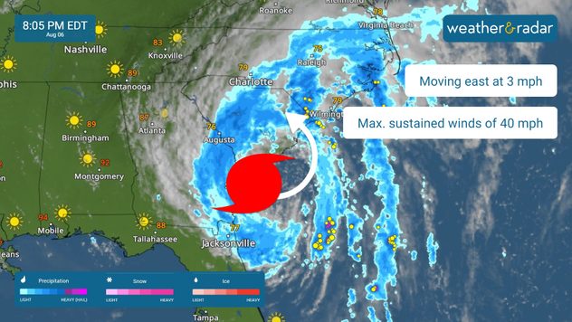
8:00 p.m. ET
7:00 p.m. ET
6:00 p.m. ET
| Location | Rain total (last 72 hours) |
|---|---|
| North Charleston, S.C. | 9.44 inches |
| Savannah, Ga. | 9.05 inches |
| Waycross, Ga. | 7.13 inches |
| Valdosta, Ga. | 5.15 inches |


