Home
Weather New York
WeatherRadar
RainRadar
TemperatureRadar
WindRadar
LightningRadar
Weather News
Editor's Pick
Discover the app
Weather widget
Contact us
Apps
Career
    Home / Weather News /

    What to expect from the tropics in August

07:00 PM
September 3, 2025

September spike
Hurricane season peak approaches

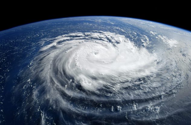
Satellite image of a hurricane via Shutterstock. - © Shutterstock

Atlantic hurricane season is underway, and statistically, September is the peak month for activity.

The Atlantic Hurricane Season is underway, and we are nearing what is typically the most active part of the season. The peak of Atlantic hurricane season is September 10, with most activity occurring between mid-August and mid-October.

Weather & Radar hurricane alertsread more

In September, storm development favors the tropical Atlantic westward across the Caribbean and Gulf, and northwestward into the western and central Atlantic.

The peak of hurricane season in the Atlantic occurs as sea surface temperatures reach their peak, shear remains low and other factors that aid in the growth of tropical cyclones come into play.

During hurricane season, the Weather & Radar app has multiple ways to keep you up-to-date. The WeatherRadar offers a close look at storms as they develop. Notice the difference between Tropical Storm Ophelia and Hurricane Beryl? You can see the defined eye on Hurricane Beryl.

Our WindRadar provides an additional view of tropical storms and hurricanes. You'll see higher wind speeds showing up on the WindRadar as a tropical storm strengthens into a hurricane.

Want the latest news on what's happening in the tropics? You can also get the latest tropical updates in our Daily Brief during hurricane season.

Mary Mays
More on the topic
Super Typhoon Bavi threatens Taiwan. 155 mph winds. . Weather Videos. Wednesday, July 8, 2026
The image shows an intense tropical cyclone over the western Pacific, east of Taiwan and the Philippines. The centre of the system is depicted as a light purple and white vortex with a clearly visible eye, surrounded by a ring of red and orange areas indicating the strongest wind speeds. A white arrow marks the typhoon’s predicted track towards the north-west, in the direction of Taiwan. To the west of the storm lie the Philippines, with the cities of Manila and Cebu; to the north of these lies Taiwan, with Taipei. Further west, the Chinese coast, including Hong Kong, and parts of Vietnam can be seen. The coloured wind map shows predominantly green areas outside the storm’s core, indicating significantly weaker winds. White streamlines illustrate the typhoon’s anti-clockwise circulation in the Northern Hemisphere. The highest wind speeds are concentrated around the eye of the cyclone.
Weather VideosWednesday, July 8, 2026

155 mph winds

Super Typhoon Bavi threatens Taiwan
What are weather fronts?. Weather explained. . . Sunday, August 23, 2026
Image of a temperature radar showing a clear distinction between a warm and cold air mass separated by a cold front.
Sunday, August 23, 2026

Weather explained

What are weather fronts?
High pressure & extreme heat. Why & how does it work?. . . Sunday, July 12, 2026
Sunday, July 12, 2026

Why & how does it work?

High pressure & extreme heat
All weather news
This might also interest you
Be ready for tropical activity. Tips & tools. . . Saturday, August 29, 2026
Track hurricanes with the WeatherRadar
Saturday, August 29, 2026

Tips & tools

Be ready for tropical activity
100 days of at least 100°F. Phoenix. . . Wednesday, August 26, 2026
Wednesday, August 26, 2026

Phoenix

100 days of at least 100°F
Catch an eerie red moon. Striking view. . . Thursday, August 27, 2026
Thursday, August 27, 2026

Striking view

Catch an eerie red moon
All articles
Weather & Radar

Weather & Radar is also available on

Google Play StoreApp Store

Company

Contact us Privacy policy Legal info Accessibility statement

Services

Uploader

Socials

instagramfacebookthreadslinkList