Home / Weather News /

Part two: July - December, 2023 weather year-in-review

02:00 PM
December 30, 2023

Part two: July - December
2023 weather year-in-review

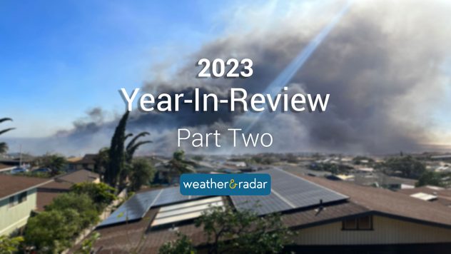
Smoke from the Lahaina wildfires that took place in August 2023.Smoke from the Lahaina wildfires that took place in August 2023. - © picture alliance

This year was so busy we had to break it into two parts! Here is part two of Weather & Radar’s 2023 weather year-in-review.

July

Just after the Independence Day holiday, Florida experienced heat indices in the triple digits! Heat advisories were issued for 52 of the 67 counties across Florida. This would continue through the rest of the workweek in the first week of July.

By Monday, July 10th, Northeast residents were dealing with extreme flooding, especially in Vermont. New York’s Hudson Valley received a summer’s worth of rain in one day – 10 inches! In Montpelier, Vt., more than 5 inches of rain piled up in one day with rain totals reaching almost 9 inches during the event.

Recommended external content from YouTube

We need your consent to show content from YouTube. You can withdraw your consent at any time.

I agree that content from YouTube will be displayed to me.

Settings for external content

Privacy policy

The Winooski River flooded the town of Montpelier with feet of water. Mudslides and washed-out roads occurred, slowing emergency help across the area.

More flooding was noted this same week in Arkansas where a flash flood emergency was issued. By the morning commute, more than 6 inches of rainfall had piled up since midnight. Just north of the intense rainfall, northern Arkansas was dry with heat indices in the triple digits, making it a tough weather day.

By July 24th, a near-world record sea surface temperature was recorded in Florida’s Manatee Bay, with water temperatures reaching 101.1 F. Whether or not this record is confirmed, that’s bath water for anyone!

August

August’s first day brought big-time flooding in the South. Oneonta, Ala., received 8 inches of rainfall within 24 hours on August 3rd, prompting dangerous flooding and water rescues.

By August 8th, the Maui wildfires devastated Lahaina. Gusty winds from Hurricane Dora that passed 500 miles south of the islands fueled the flames. Scary scenes were documented as many could not evacuate due to blocked roadways. Residents and visitors jumped into the ocean to flee the fires. The fires became the deadliest in U.S. history.

August also brought historical Hurricane Hilary which made its way up Baja California and eventually into SoCal, bringing gusty winds and flooding rains. Many communities saw more than a year’s worth of rain in one weekend thanks to Hilary.

The very same day Hilary hit, on August 20th, a 5.1 magnitude earthquake rattled Ojai, Calif., but luckily there was little to no damage and no tsunami threat.

Not long afterward, Tropical Storm Harold made landfall in southern Texas on August 22, 2023, and Category 3 Hurricane Idalia made landfall near Keaton Beach, Fla., on August 30. Hundreds of thousands of people were without power, property was damaged, and even the Steinhatchee River in Florida changed flow direction due to the winds and storm surge.

September

Meteorological autumn began and the temperatures and tropics were both heating up. Temperatures reached the 90s and triple digits from the southern Plains to the Midwest and Mid-Atlantic, while Hurricane Lee rapidly intensified in the Atlantic.

Hurricane Lee was recorded as the third-fastest rapidly intensifying hurricane in recorded history due to its winds increasing by 85 mph within 24 hours. Although it made landfall in Nova Scotia in mid-September, Lee turned deadly for the U.S. between the surf and rip currents as well as the gusty winds capable of knocking over trees.

The tropical activity continued, and Tropical Storm Ophelia impacted the Southeast on September 23rd bringing rough surf, gusty winds, and heavy rainfall. It made landfall near Emerald Isle, N.C.

In September’s final days, New York City received historic flooding. Roads were impassable, basements flooded, and Friday, September 29th, was the wettest day on record for JFK with at least 7.88 inches falling since midnight. The record to beat was 7.80.

October

Severe weather, the first big cold temperature wave, and Tropical Storm Philippe all headlined October’s first week.

On October 14th, we shifted gears to the space beyond our atmosphere to watch the annular solar eclipse make its way from Oregon to Texas. Many traveled to see this eclipse as it was almost a total eclipse, but we are getting ready for the total solar eclipse to pass over the U.S. on April 8th, 2024.

The U.S. was split between summer and fall temperatures as the autumn equinox approached. Western heat continued to crank but the East was seeing cold front after cold front. This eventually led to the season’s first Nor’easter, which also coincided with the seventh rainy weekend in a row for the Northeast.

By the end of the month, we saw Major Hurricane Otis slam into Acapulco, Mexico as a category 5 major hurricane. Sustained winds of 165 mph and rainfall amounts greater than 20 inches made Otis one for the history books for Mexico.

November

After a slow start, the Pacific Northwest finally kicked off the rainy season the first week of November with a train of storms. Up to 5 inches of rainfall and winds greater than 60 mph were forecast as each storm moved in that first weekend of the month.

On Tuesday, November 7th, we saw the second super fog occurrence across New Orleans and unfortunately, the event became deadly. The combination of fog mixed with smoke from brushfires caused thick super fog to reduce visibility to almost zero. Accidents happened and many were delayed as traffic was slow to move.

Inches of flooding rains marked November 14th and 15th in southern Florida as a stationary front sat over the Gulf and sent in wave after wave of heavy rain. Cars stalled in the floodwaters as more than 9 and 10 inches of rain fell.

November ended with a lake-effect snow event across the Great Lakes. Schools and businesses closed for the day on November 28th, and more than a foot of snow was in the forecast for many. Winter weather advisories and winter storm warnings were issued.

December

Meteorological winter may have begun at the start of the month, but December had above-average temperatures to start, especially in the nation’s midsection. This warmth eventually fueled a severe weather outbreak across the lower Ohio and Tennessee valleys. A deadly nocturnal tornado was caught on camera just north of Nashville.

Just as many were getting ready to hit the road for holiday travel the week before Christmas, a storm system was bringing heavy flooding rains and mountain snow to SoCal. The event lasted three days and brought intense flooding to Santa Barbara.

2023 was BUSY when it came to the weather world. Did you miss part one of our year-in-review? Check it out here. We wish you a safe and happy New Year from Weather & Radar USA!

Becca Parker
More on the topic
Sunday, April 13, 2025

Your weather - Your shots

An international spring collection
Sunday, March 30, 2025

Your weather - Your shots

Spring tranquillity across the pond
Man sits with telescope looking up at the Milky Way.
Tuesday, April 1, 2025

April astronomy outlook

A micromoon & the oldest known meteors
All weather news
This might also interest you
Monday, May 19, 2025

The RainRadar

When it pours, it's purple
Friday, May 23, 2025

Breakfast Brief

Strong storms in the Plains
Thursday, May 22, 2025

2025 hurricane prediction

Above-average expected
All articles
Weather & Radar

www.weatherandradar.com

instagramfacebookthreadsContact uslinkList
Privacy policy | Legal info