Home
Weather New York
WeatherRadar
RainRadar
TemperatureRadar
WindRadar
LightningRadar
Weather News
Editor's Pick
Discover the app
Weather widget
Contact us
Apps
Career
    Home / Weather News /

    What is tule fog?

04:56 PM
January 12, 2026

Radiation Fog
What is tule fog?

Tule fog is a thick, ground-hugging fog that forms in California’s Central Valley during the late fall and winter months. This fog is known for reducing visibility to just a few feet, creating hazardous travel conditions and dramatically changing the landscape.

You'll often see a thick fog forming over California's Central Valley this time of year on the WeatherRadar. It's called tule fog, and it's a type of radiation fog that forms when specific weather conditions come together. After winter rain saturates the valley floor, clear skies and calm winds allow heat to escape from the ground at night. This cooling causes the moist air near the surface to condense into tiny water droplets, creating dense fog.

Because the Central Valley is surrounded by mountains, cold, moist air can pool easily, making the region especially prone to tule fog. Once established, the fog may persist all day.

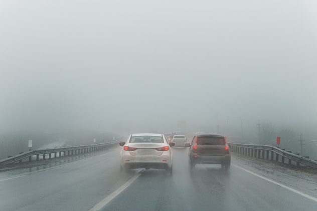
Image of fog via Shutterstock
Image of fog via Shutterstock. - © Shutterstock

While tule fog plays a role in the region’s climate and agriculture, it is also one of California’s most dangerous weather phenomena, contributing to multi-vehicle accidents and travel disruptions each winter. Keep an eye on the WeatherRadar to spot when this weather phenomenon is in the forecast.

Mary Mays
More on the topic
How does fog form?. Multiple ways. . . Saturday, July 11, 2026
Saturday, July 11, 2026

Multiple ways

How does fog form?
Super Typhoon Bavi threatens Taiwan. 155 mph winds. . Weather Videos. Wednesday, July 8, 2026
The image shows an intense tropical cyclone over the western Pacific, east of Taiwan and the Philippines. The centre of the system is depicted as a light purple and white vortex with a clearly visible eye, surrounded by a ring of red and orange areas indicating the strongest wind speeds. A white arrow marks the typhoon’s predicted track towards the north-west, in the direction of Taiwan. To the west of the storm lie the Philippines, with the cities of Manila and Cebu; to the north of these lies Taiwan, with Taipei. Further west, the Chinese coast, including Hong Kong, and parts of Vietnam can be seen. The coloured wind map shows predominantly green areas outside the storm’s core, indicating significantly weaker winds. White streamlines illustrate the typhoon’s anti-clockwise circulation in the Northern Hemisphere. The highest wind speeds are concentrated around the eye of the cyclone.
Weather VideosWednesday, July 8, 2026

155 mph winds

Super Typhoon Bavi threatens Taiwan
Europe: Warmest June on record. Warm waters too. . . Friday, July 10, 2026
The record-breaking heatwave in June has made climate history in Western Europe.
Friday, July 10, 2026

Warm waters too

Europe: Warmest June on record
All weather news
This might also interest you
100 miles, 30-degree difference. Southern California. . . Thursday, July 9, 2026
Thursday, July 9, 2026

Southern California

100 miles, 30-degree difference
Saharan dust to reach Florida. Dry period expected. . . Tuesday, July 7, 2026
Saharan dust seen on the satllite image (right) moving westward toward Florida. Air quality impacts are expected.
Tuesday, July 7, 2026

Dry period expected

Saharan dust to reach Florida
6 easy steps to take now to be ready. Hurricane preparedness. . . Sunday, July 12, 2026
Are you ready?
Sunday, July 12, 2026

Hurricane preparedness

6 easy steps to take now to be ready
All articles
Weather & Radar

Weather & Radar is also available on

Google Play StoreApp Store

Company

Contact us Privacy policy Legal info Accessibility statement

Services

Uploader

Socials

instagramfacebookthreadslinkList