Home / Discover the app /

Breakfast Brief: Rain on the downtrend, smoke expands

Breakfast Brief
Rain on the downtrend, smoke expands

While showers and thunderstorms are set to continue across the South and Southeast, frequency and coverage will be on the downtrend. Meanwhile, extreme heat grapples the northern High Plains as smoke expands across the nation.

As we head into the weekend, this soggy pattern across the South and Southeast U.S. will finally begin to break down as high pressure builds in. However, with the rain and clouds clearing out, expect temperatures to be on the rise.

Did you know?

On this day in 2013, Oklahoma City experienced severe flash flooding due to intense thunderstorms, with rainfall rates reaching up to 9 inches per hour in some areas. This event led to widespread road closures, water rescues, and a record rainfall of 3.53 inches at Will Rogers Airport.

LocationNew record temperature WednesdayDegrees above normal
Boise, Ida.107°F12
Pocatello, Ida.101°F10
Salt Lake City105°F10
Missoula, Mont.102°F14
The table above lists several locations that broke their daily high temperature records on Wednesday and the degrees to which these new temperatures exceed the historical average for each location.
View from Vesuvius Bay of smoke billowing from an out-of-control bush fire near Ladysmith in British Columbia, Canada, on August 19, 2021. Similar wildfires affect the province today.

The heatwave sweeping across the northern High Plains will continue its eastward march. Although widespread temperature records aren't expected today as they were earlier this week, temperatures will remain dangerously high. Many areas from the Dakotas to Oklahoma could see afternoon highs reaching over 100°F.

Nearly 100 wildfires are burning across the U.S. West Coast and southwest Canada, with the most severe in Oregon and Washington. The fires are causing extensive smoke and haze, worsening air quality in the region. Strong westerly winds carry the smoke to the East Coast, affecting air quality in cities across Delaware, New Jersey, Cape Cod, New Hampshire, New York City, and parts of Maine.

Tropical update:

Tropical Storm Bud is active in the Eastern Pacific, moving westward with 20-25 knots winds, and is not expected to threaten land. In the next seven days, no other tropical activity is expected in the Eastern Pacific or Atlantic Oceans.

The news we're covering today:

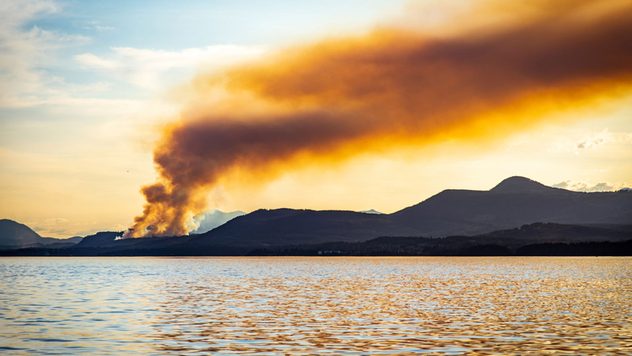
  • Dozens of wildfires burn across the U.S. West Coast

Did you miss these?

Heavy rain may relieve Carolina droughtread more
Typhoon Gaemi's strange loopSee the images
Saharan dust plumes on the moveSee the images

App news & updates

We've made a few changes to the Weather & Radar app on Android. When you delete your old home location, your current location becomes your new home location. This update is available with version 2024.15.1.

Download the app now
More app features
Image detailing the WeatherRadar on Weather & Radar USA

Exploring app features

The WeatherRadar our most popular tool
WeatherRadar and WindRadar view of a bomb cyclone impacting the Pacific Northwest on Tuesday, November 19, 2024

Extreme weather explained

What is a bomb cyclone?
Image shows and example of the WindRadar over Chicago, Illinois showing winds up to 30 mph across the city.

App feature

Learn about the WindRadar
All app features
Weather & Radar

www.weatherandradar.com

instagramfacebookthreadsContact uslinkList
Privacy policy | Legal info