Home / Editor's Pick /

Breakfast Brief - Heat builds across the West

09:00 AM
September 5, 2024

Breakfast Brief
Heat builds across the West

A heat wave is building across the West, bringing record highs to the Pacific Northwest. Flash flooding remains a concern across the northern Gulf Coast.

A ridge of high pressure building across the West will keep the region in a heat wave over the next few days. The TemperatureRadar shows highs reaching the 110s in the Desert Southwest, the 100s to near 110 in southern California, the mid-100s for the central California Valleys, and the low 100s for portions of the Pacific Northwest.

This day in weather history

Hurricane Easy produced the greatest 24 hour rainfall in U.S. weather records. The hurricane deluged Yankeetown, on the upper west coast of Florida, with 38.7 inches of rain.

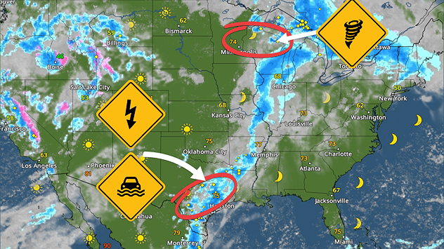
A stationary front and coastal low drive multiple days of widespread showers and thunderstorms across the Gulf Coast. The heaviest rain is expected over portions of the central and upper Texas Gulf Coasts and a bit further north into the lower Mississippi Valley. Rainfall rates between 2 and 3 inches per hour could lead to flash flooding in cities like Galveston, Texas, New Orleans, and Jackson, Miss. Keep an eye on the WeatherRadar.

A front will also bring showers and storms from the Rockies to the Great Lakes. While severe weather is not anticipated, some localized flash flooding is possible. Elsewhere, pleasant conditions prevail across the Northeast, Ohio Valley, and northern Mid-Atlantic.

Tropical update:

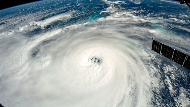
There are four areas that we are keeping an eye on in the Atlantic Basin. While all four areas have a low chance of development over the next 7 days, Weather & Radar's expert meteorologists will keep an eye on conditions in the Atlantic Basin. Hurricane Season lasts through November 30th, and there's plenty of time for more development.

The news we're covering today:

  • Heatwave for the West
  • Flooding threat for the Gulf Coast
  • Pleasant for the Northeast

Did you miss these?

100 days of 100 degrees in Phoenixread more
Record heat for the Northwestread more
Flood threat continuesread more

App news & updates:

Are you ready for flooding or severe weather? Weather & Radar is here to help warn you about dangerous conditions. Click here to learn how to turn on your Weather & Radar app alerts.

Mary Mays
More on the topic
Man sits with telescope looking up at the Milky Way.
Sunday, September 7, 2025

September astro outlook

Equinox dominates the month
Dust cloud over Tucson alongside weather radar showing thunderstorms in Arizona.
Sunday, August 31, 2025

Fascinating phenomenon

Dust storm hit Phoenix last week
On the left, a satellite image of a hurricane over the sea; on the right, a man in a clearance vehicle clearing debris and food in a flooded supermarket.
Friday, August 29, 2025

Twenty years ago today

Hurricane Katrina hit Gulf Coast
All weather news
This might also interest you
Monday, September 15, 2025

Utah and the Dakotas

Unusual September tornadoes
Hurricanes approaching the coastline can cause extensive impacts, including flooding, even before landfall.
Saturday, September 13, 2025

Knowledge is power

What to know this hurricane season
Tuesday's daily briefing - September 16, 2025
Tuesday, September 16, 2025

Daily briefing

Toasty temps & isolated flooding
All articles
Weather & Radar

www.weatherandradar.com

instagramfacebookthreadsContact uslinkList
Privacy policy | Legal info | Accessibility statement