Home
Weather New York
WeatherRadar
RainRadar
TemperatureRadar
WindRadar
LightningRadar
Weather News
Editor's Pick
Discover the app
Weather widget
Contact us
Apps
Career
    Home / Weather News /

    Keep an eye on the TemperatureRadar: Who sees sweltering heat

02:56 PM
May 15, 2024

Who sees sweltering heat
Keep an eye on the TemperatureRadar

Summer is right around the corner but for some in the South, it feels like it has already arrived as temperatures soar.

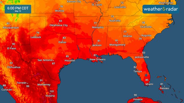
Dangerous heat is building in across south Florida and south Texas today through the end of the week. The TemperatureRadar shows highs surging into the 90s across these regions, with plenty of moisture also in the mix. This combination of heat and humidity can be deadly, so take steps to stay cool and out of the heat.

TemperatureRadar

Florida

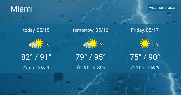
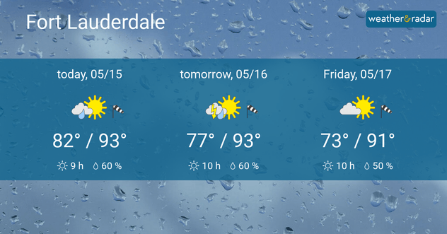
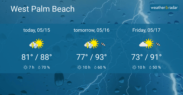
Across the Sunshine State, you can see persistent southwest winds on our WindRadar, which is setting the stage for hot weather, even by Florida standards. High will reach the 90s in cities like Miami, Fort Lauderdale, and West Palm Beach, Fla., this week. Some of the most dangerous heat and humidity will build into southern Florida today and tomorrow.

Miami forecast
Fort Lauderdale forecast
West Palm Beach forecast
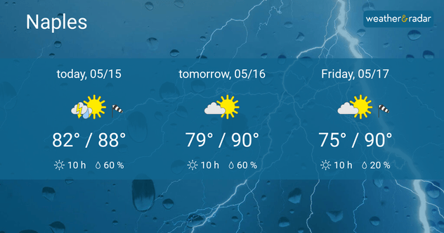
Naples forecast
1/4

The heat will also help spark storms across the Florida peninsula, with strong storms also building across the southern and central Plains as well as the Carolinas.

Who will see severe weather todayread more

Texas

Hazardous heat will also build into south Texas as a warm front moves in from the Gulf of Mexico. Highs will be in the 90s across south Texas through the end of the week.

Heat safetyread more

Cities such as Brownsville, McAllen, and Corpus Christi, Texas will surge into the mid-90s through the end of the week. Moisture moving in from the Gulf will cause humidity levels to surge, making this heat dangerous.

More on the topic
Hawaii's second 2026 hurricane impact. Hurricane Lowell. . . Tuesday, September 8, 2026
Tuesday, September 8, 2026

Hurricane Lowell

Hawaii's second 2026 hurricane impact
All about nocturnal severe weather. Risks & preparedness. . . Saturday, August 22, 2026
Saturday, August 22, 2026

Risks & preparedness

All about nocturnal severe weather
Record ocean heat halting hurricanes. Strong El Niño influence. . . Sunday, September 13, 2026
A weather map shows a calm Atlantic Ocean with no hurricanes, alongside a picture of the sea.
Sunday, September 13, 2026

Strong El Niño influence

Record ocean heat halting hurricanes
All weather news
This might also interest you
1,000+ miles of storms. 3 Time zones of action. . . Wednesday, September 9, 2026
Wednesday, September 9, 2026

3 Time zones of action

1,000+ miles of storms
What is it, and why is it important?. North American Monsoon. . . Sunday, September 6, 2026
Desert thunderstorm
Sunday, September 6, 2026

North American Monsoon

What is it, and why is it important?
Peak season but no activity. Atlantic Basin. . . Thursday, September 10, 2026
A quiet Atlantic at the peak of Atlantic Hurricane Season.
Thursday, September 10, 2026

Atlantic Basin

Peak season but no activity
All articles
Weather & Radar

Weather & Radar is also available on

Google Play StoreApp Store

Company

Contact us Privacy policy Legal info Accessibility statement

Services

Uploader

Socials

instagramfacebookthreadslinkList