Weather & Radar
Home / Weather News /

Pineapple Express slams the West Coast with heavy rain and snow

02:38 PM
February 1, 2024

Heavy rain and snow
Pineapple Express slams the West Coast

Recommended external content from YouTube

We need your consent to show content from YouTube. You can withdraw your consent at any time.

I agree that content from YouTube will be displayed to me.

Settings for external content

Privacy policy

A Pineapple Express is bringing heavy rain, snow, and high winds to the West Coast, increasing the threat of flash flooding, power outages, wind damage, and landslides.

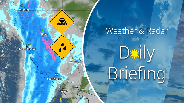
A Pineapple Express is a tropical atmospheric river that has origins near Hawaii. As our WeatherRadar shows, this robust plume of moisture has arrived and is impacting the West Coast, and it will continue through the rest of the week. Flash flooding, power outages, and landslides are all concerns as this tropical moisture pours in.

Our reporter is on-site in Donner Pass and Soda Springs, Calif., and explains while this is a significant snowfall event, the Sierra Nevadas are currently under snow drought. Attention will shift to next week when a second round of heavy rain and snow renews flood risk and travel disruptions across the region.

In addition to heavy rain and mountain snow, powerful winds may lead to wind damage and power outages. This system is just getting started, with moisture spreading further inland later today.

Today's heavy rainToday's heavy rain risk

First, let's talk about the moisture. Flood watches extend across northern and southern California, with the San Francisco Bay area, Sacramento, Los Angeles, and San Diego metros at risk for flooding and landslides Wednesday into Thursday. Winter storm warnings and winter weather advisories are in place for the Sierra Nevada and the southern California mountain ranges.

Rain amounts will range from 1 to 4 inches throughout California and into Oregon. The highest rain totals, up to 6 inches, are expected across northern California into southwest Oregon. Snow totals through Friday will vary depending on elevation. In the Sierra, an incredible 3 to 4 feet will be possible above 7,000 feet, with 2 to 3 feet expected between 6,000 and 7,000 feet and 1 to 2 feet expected between 5,000 and 6,000 feet. With snow in the forecast at pass levels, it's important to check road conditions before traveling.

High winds are accompanying the rain. Gusts up to 35 mph will hit the mountains of southern California today as the rain moves through. Make sure you bring in any outdoor objects that may blow away, and be prepared for some white-knuckle drives through the mountains today.

If that wasn't enough, another significant storm and plume of moisture will impact the Golden State Sunday into early next week. This system will bring more rain, snow, and wind to the West Coast, and Weather & Radar's expert meteorologists will keep you up-to-date.

James West
More on the topic
Man sits with telescope looking up at the Milky Way.
Tuesday, April 1, 2025

April astronomy outlook

A micromoon & the oldest known meteors
Sunday, April 13, 2025

Your weather - Your shots

An international spring collection
easter
Sunday, April 20, 2025

A chance to reflect

Happy Easter to all
All weather news
This might also interest you
Monday, May 5, 2025

Damaging winds, floods

More severe storms for South Florida
Thursday, May 8, 2025

Breakfast Brief

Stormy southeast, tranquil West Coast
Monday, May 5, 2025

You can be ready

When severe storms strike...
All articles
Weather & Radar

www.weatherandradar.com

instagramfacebookthreadsContact uslinkList
Privacy policy | Legal info