Wednesday's live blogDangerous severe threat for the South
3:45 p.m. CT
3:00 p.m. CT
2:00 p.m. CT
1:30 p.m. CT
Louisiana- 137,601 Mississippi- 52,269 Texas- 37,690 Alabama- 12,681
12:30 p.m. CT
12:15 p.m. CT
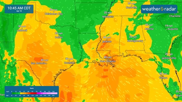
11:00 a.m. CT