Monday's live blogDangerous tornado outbreak developing
Recommended external content from YouTube
We need your consent to show content from YouTube. You can withdraw your consent at any time.
8:30 p.m. CDT
8:00 p.m. CDT
7:20 p.m. CDT
6:50 p.m. CDT
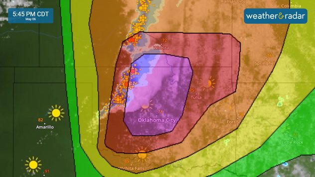
5:45 p.m. CDT