Weather & Radar
Home / Weather News /

Southeast historic rain - Debby strengthens: big impacts for Fla., Ga., S. Ca.

06:10 PM
August 4, 2024

Southeast historic rain
Debby strengthens: big impacts for Fla., Ga., S. Ca.

Settings for external content

Privacy policy
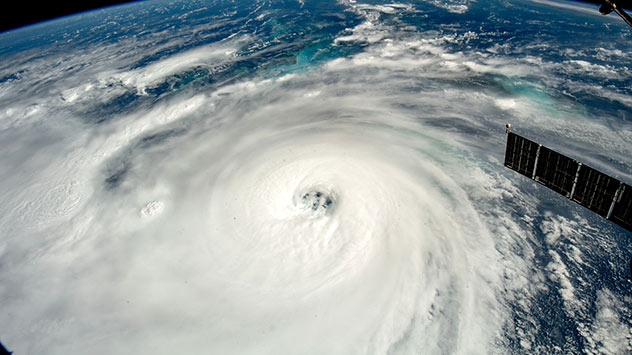
Debby continues to intensify and is on the verge of becoming a hurricane. It is heading toward Florida and moving over very warm waters of the Gulf of Mexico. It is likely to rapidly intensify tonight and slow down once it reaches land.

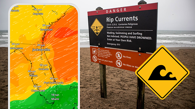
Debby's rainbands are affecting the Florida Peninsula on Sunday bringing in storm surge across western Florida, heavy rain, thunderstorms and the risk for tornadoes, especially for Central, North and eastern Panhandle. These risks will continue and intensify overnight as Debby inches closer to the Big Bend area. The forecast calls for Debby to make landfall on Monday morning between the Big Bend and the Panhandle as it starts to make a northeasterly turn.

The turn to the northeast and east will bring major and prolonged problems across a big chunk of the Southeast. Debby will come to a crawl between Monday and Wednesday, traveling a mere 250 miles in those two days. Historic rainfall is forecast for South Carolina and eastern Georgia. Rainfall could exceed 30 inches in some spots. For Florida, a swatch of rainfall between 8-12 inches is possible along I-10 from Tallahassee to Jacksonville.

The worst storm surge, that could cause deaths, is forecast for areas east of where the center of the storm makes landfall, with some areas along the Big Bend to exceed 10 feet. The winds will reach hurricane-force across the Big Bend early Monday as the storm approaches. Expect weather conditions to quickly deteriorate this afternoon and continue bad through Monday afternoon for Florida. Debby's first rainbands will arrive in Georgia and South Carolina late afternoon on Sunday and continue through at least Wednesday.

We are closely monitoring Debby as it move to the north and all the impacts it will bring to the Southeast. Our weather reporter Jonathan Petramala will be following the storm and we will have updates from areas most affected. Our team of meteorologists will bring you updates frequently. Make sure your alerts are on and you heed authorities' orders.

Irene Sans
More on the topic
easter
Sunday, April 20, 2025

A chance to reflect

Happy Easter to all
Sleeping cat
Sunday, April 20, 2025

Seasonal tiredness

What causes spring fatigue?
Happy Earth Day
Tuesday, April 22, 2025

Employ renewable energy

Earth Day 2025 - Our Power, Our Planet
All weather news
This might also interest you
Wednesday, May 7, 2025

Rain piling up

Growing flood threat for New Orleans
Wednesday, May 7, 2025

Breakfast Brief

Omega block starts to break down
Tuesday, May 6, 2025

Breakfast Brief

Blocking pattern brings dangerous rain
All articles
Weather & Radar

www.weatherandradar.com

instagramfacebookthreadsContact uslinkList
Privacy policy | Legal info